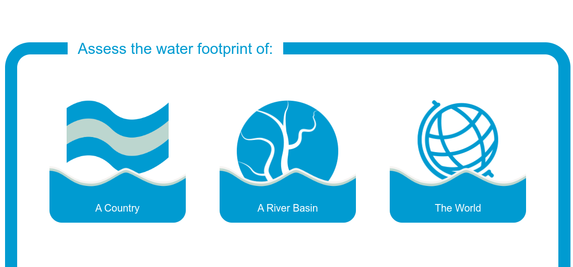
Water Footprint Assessment Tool
This tool combines the internationally recognised Global Water Footprint Standard with WaterStat, the world's most comprehensive water footprint database. It allows the geographical evaluation options of a country, a river basin or the whole world to be carried out.
Developed by Water Footprint Implementation (WFI) and Water Footprint Network (WFN)
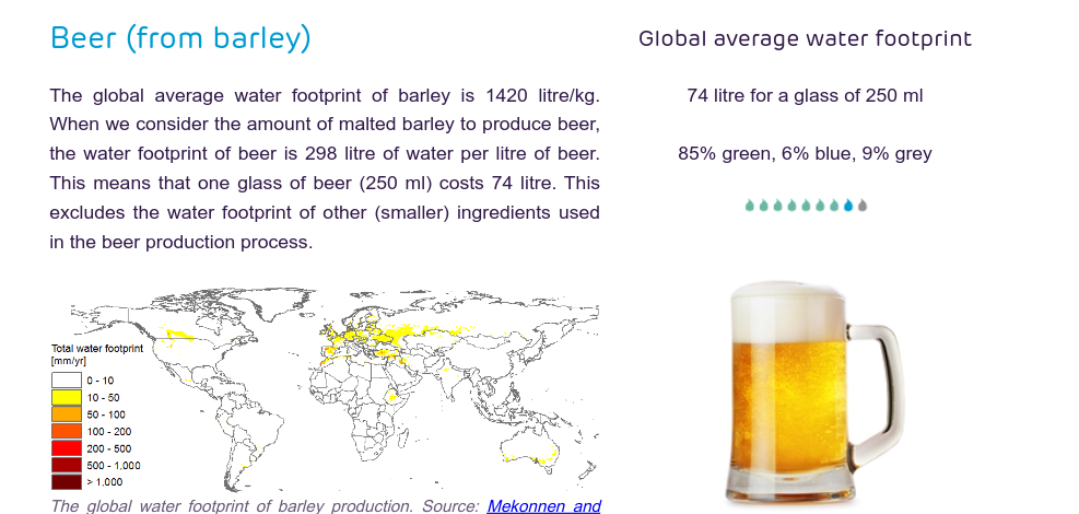
Product Gallery
The Water Footprint Network's Product Gallery helps you learn which foods are more water intensive, which are less water intensive and how polluting their production is. Get an overview of the impact of your daily lifestyle by comparing the amount of water used to make various foods.
Developed by Water Footprint Network (WFN)
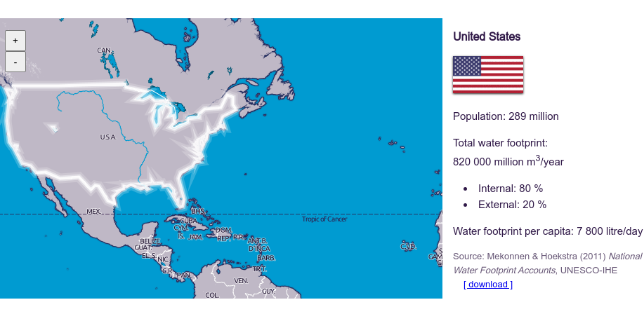
National Water Footprint Explorer
This innovative tool allows you to explore in detail the water footprint of different countries and their citizens. The National Water Footprint Explorer allows you to make comprehensive comparisons between nations and analyze the composition of their water consumption. The tool allows a breakdown of the internal and external water footprint for each country.
Developed by Water Footprint Network (WFN)
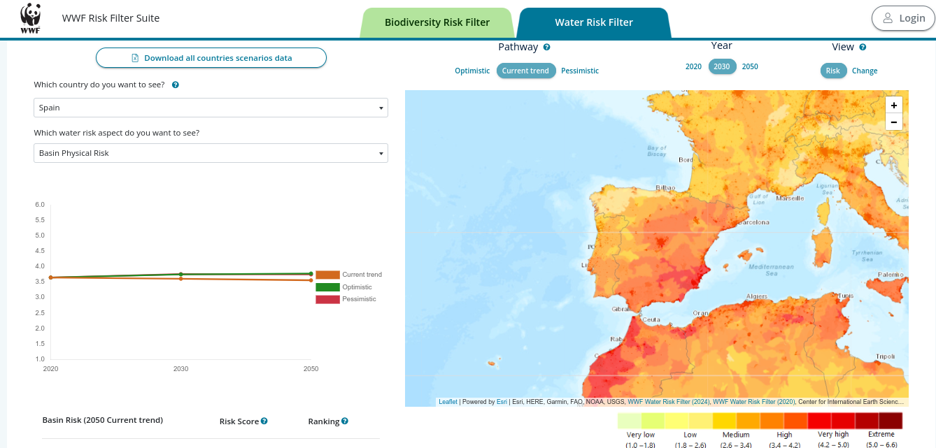
Water Risk Filter
This corporate and portfolio-level assessment tool helps companies and investors prioritize actions on which aspects and where it is most important to address water risks. Developed by WWF, it aims to improve business resilience and contribute to a sustainable future.
Developed by World Wide Fund for Nature (WWF)
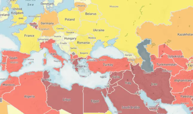
Aqueduct Tools
Aqueduct's tools use open source data to map water hazards such as floods, droughts and water stress. Its suite includes the Water Risk Atlas, which analyzes current and future risks; the Country Rankings, which compares risks at the national and subnational levels; Aqueduct Food, focused on risks to agriculture and food security; and Aqueduct Floods, which identifies coastal and river flood risks.
Developed by World Resources Institute (WRI)
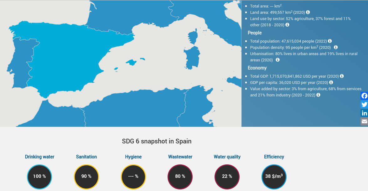
SDG6 Data Portal
UN-Water's SDG 6 platform is a one-stop information hub that unifies all UN water and sanitation data. This tool presents hydrological, environmental and socioeconomic information through interactive infographics, targeting a wide range of users, from policy makers to students.
Developed by the United Nations (UN-Water)